
South Australians are being warned of “very high fire danger” today as severe weather conditions sweep the state.
Temperatures are expected to reach the mid-20s with dry northerly winds and virtually no rainfall forecast.
Fire authorities said while these types of conditions were uncommon so close to winter, there have already been some close calls over the weekend.
A grassfire at Mylor in the Adelaide Hills burned about four hectares before it was contained by about 35 firefighters yesterday afternoon, highlighting the risk to affected communities.
Country Fire Service Duty Commander Brett Loughlin said several backburning operations got out of control due to the dry conditions.
“The Mylor incident was one of dozens of escaped burns that have occurred this weekend and it’s really clear to us that people are underestimating the level of risk,” Mr Loughlin told Weatherzone.
The CFS has urged landowners to think twice before embarking on any burn off operations today because “dry fuels and wind will be enough to see a fire quickly catch and take off”.
Dangerous winds are also likely to slam the SA coast with a vigorous northerly airstream developing ahead of a cold front in the west, which will generate rain, showers and storms in southern and western parts of the state.
Damaging winds are expected for the West Coast, Lower Eyre Peninsula, Eastern Eyre Peninsula, Yorke Peninsula and Kangaroo Island.
Northerly winds will increase today, with gusts of 90 to 100 km/h possible over the warning area In coming hours. Winds may also briefly average 55 to 65 km/h.
Locations which may be affected include Port Lincoln, Ceduna, Wudinna, Cleve, Kimba and Maitland. Onshore winds are bringing light showers to eastern parts of NSW and Queensand east coast.
While parts of NSW woke to a wet morning, some areas, including Sydney and the Blue Mountains saw high levels of fog – with drivers warned to take care on the roads.
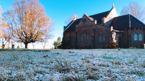
Other areas inland also saw strong frost this morning, with last week’s icy conditions continuing before the sun rose.
Further north, Queenslanders are being warned of hazardous surf conditions with large swells expected around Fraser Island Coast, Sunshine Coast Waters and Gold Coast Waters.
A high is keeping elsewhere dry and mostly clear.
This content first appear on 9news