
A cold front will cross lower parts of the southeast of Australia today bringing strong winds, cooler temperatures, showers and the odd storm.
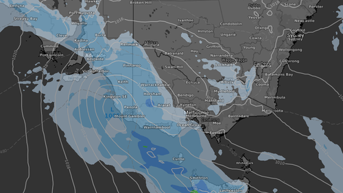
The Upper South East and Lower South East of the state are expected to be slammed with damaging southerly winds, averaging 60-70 km/h with peak gusts of 90-100 km/h possible during the afternoon.
Locations which may be affected include Meningie, Robe, Millicent and Lucindale.
Tasmania will experience the strongest winds with the system, peaking over 70 km/h this morning.
The strongest winds should be felt across the western and southern coasts.
Widespread showers should have largely cleared by this evening.

Wind warnings are also in place for Victoria, NSW, Queensland, the Northern Territory and WA today.
Daytime temperatures on Monday will drop a few degrees for Adelaide and Melbourne compared to Sunday, although wind chill will make the two cities feel 3C to 4C cooler than actual.
Canberra and Sydney will miss the majority of the cold front as it remains further south as it moves into the Southern Tasman Sea.
Onshore winds are causing a few showers over southern Western Australia and northeastern Queensland.
High pressure is keeping elsewhere mostly dry and settled.
This content first appear on 9news